Forecasters on alert as fresh potential cyclone looms

RNZ
06 February 2023, 9:10 PM
 MetService is keeping 'all eyes on the Pacific' as a tropical cyclone appears likely to brew over the Coral Sea and threaten the upper North Island this coming weekend.
Auckland motorists are being urged to prepare for packed roads and slow-moving traffic today as forecasters warn the flood-ravaged city could be hit by another fierce weather system later this week.
MetService has "all eyes on the islands" as a tropical low that may turn into a cyclone threatens to breach New Zealand's shores in the coming days.
"If this system does pass close to the North Island, it will be another significant weather event potentially affecting vulnerable areas which are still recovering from recent severe weather," MetService said yesterday.
A potential cyclone is the last thing Auckland needs as residents across the city continue to clean up after unprecedented rainfall sparked severe flooding that inundated homes, triggered numerous slips and claimed the lives of four people late last month.
And with the return to school and work after the long weekend, Tuesday is expected to be a busy day for the Auckland Transport network.
Motorists are being asked to prepare for this accordingly by planning ahead and leaving plenty of time for travel.
AT spokesperson Darek Koper said the organisation would be providing regular updates on its website so people had the information they needed to plan their journeys.
As of last night, 29 roads were still closed or partially closed across Auckland due to the widespread damage caused by the devastating floods.
Slip-ravaged Tāmaki Drive was expected to open with one lane soon, while Ngapipi Rd in Ōrākei, Shore Rd in Remuera and Kemp Rd in Massey have reopened, Auckland Emergency Management said.
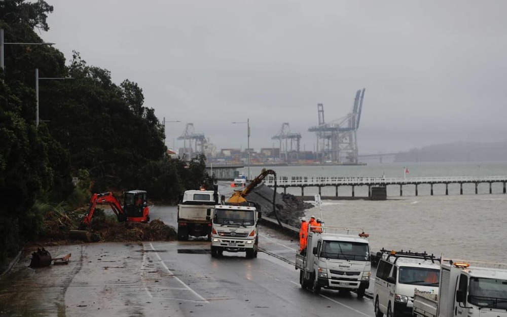
Workers clear a large slip on Tamaki Drive between Okahu Bay and Mission Bay.
AEM said work continued yesterday reconnecting the city after slips and floods impacted roads and a bridge was washed away in Rodney.
AT and contractors aimed to have a new bridge on Mill Flat Rd, near Riverhead, fully open by Wednesday. AEM said it was trying to open the bridge to residents yesterday.
"Be prepared for longer journey times due to more Aucklanders travelling around and the remaining damage to our road and public transport network," Koper said.
He confirmed that scheduled buses would be operating as usual from today however there could be some last-minute cancellations due to the ongoing bus driver shortage.
Koper said people may want to consider walking or biking to school or work, but MetService warned that might not be possible all week as a fresh cyclone threatened to bring more rain to Auckland.
It was expected to hold off today, however, with the city likely to see a mainly fine, 24C day with some isolated showers in the west.
MetService meteorologist Jessie Owen said the upcoming week would bring milder temperatures across the nation and a break from the humid and sticky weather in the north.
However, the finer weather could prove to be brief.
"All eyes are now on the tropics," MetService said.
A cyclone was likely to develop in the Coral Sea, between New Caledonia and Australia in the Pacific, from a tropical low-pressure system in the next few days.
Windy.com predicts on its website that the storm will likely hit our shores at midnight next Monday, bringing strong gusts up to 50 knots.
MetService meteorologist John Law told RNZ's Morning Report the area of low pressure was currently around the Solomon Islands but it was expected to deepen into a tropical cyclone and begin heading towards New Zealand around the middle of the week.

WHAT'S ON