NIWA outlook: What is NZ’s risk of tropical cyclones this season?
RNZ
12 October 2023, 7:23 PM

New Zealand's coming El Niño summer might be likely to parch the East Coast, soak the southwest and bring bothersome, blustery westerlies everywhere - but it at least comes with a lower risk of tropical cyclones.
NIWA's just-issued outlook for 2023-24 picks a normal-to-reduced risk for New Zealand's neighbourhood, which typically receives at least one unwelcome visit from a cyclone system each November-to-April season.
The last season was, of course, historic.
After Hale dumped torrential rain on Coromandel in the opening days of 2023, February's hit from Gabrielle proved our deadliest cyclone event since 1968 - and the costliest tropical cyclone to ever hit the Southern Hemisphere.
It struck amid an already extreme summer, in which the odds of big subtropical rainmakers arriving from the north had been boosted by three years of La Niña and a warmed-up West Pacific.
This time around, however, we have the reverse set-up - El Niño - which is expected to bring fewer northeasterly systems over summer, and more westerly and north-westerly flows.
Of NIWA's five assessed "analogue" years - or past seasons that had comparable characteristics with what's predicted for this one - just two saw ex-tropical cyclones veer within 550 kilometres of New Zealand.
If one did come into our region, there was a "near-equal" probability of it tracking to the east or west of the North Island - although an interaction with the South Island also couldn't be ruled out.
Further afield, NIWA predicted that between nine and 14 named cyclones could form in the Southwest Pacific over the season, with the risk higher to the east of the International Date Line.
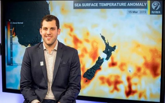
"In El Niño events past, we've seen a number of years that have had pretty active cyclone seasons in the Southwest Pacific - including several of the analogue years that we've selected," NIWA meteorologist Ben Noll said.

NIWA meteorologist Ben Noll. Photo: NZ Herald / Michael Craig
"This puts the region, as a whole, in maybe a different frame of mind to what we've seen in the last few years, and also shifts the risk profile eastward, to those typical holiday hot-spots like Fiji, Vanuatu and the northern Cook Islands, which are all in an elevated risk category this season.
"The flip side of that is the New Zealand aspect, where the risk is considered lower than last year - and also lower than the long-time normal."
Noll stressed that did not mean Kiwis could think themselves spared from any cyclone visit this season, given those analogue years still indicated a 40 percent chance.
"Overall, it's some good news: but while [cyclone activity] isn't necessarily favoured, we obviously need to remain vigilant, and we'll be continuing to track activity as the season goes along," he said.
"I'll add that, for keen surfers, this may not be a bad summer for swell coming in from distant systems, which could bring marine and coastal impacts that New Zealanders will still need to be aware of."
Although remnant warm water in the West Pacific still looked to offer a moisture source for rain-makers, Noll expected the north's exposure to subtropical "atmospheric rivers" would not be nearly as high as during what was a record-wet summer for many places.
"Near and north of New Zealand, we're expecting a subtropical ridge feature that is frequently going to be a shield."
While there would be times when the strength of this large high-pressure zone ebbed enough to allow systems through, Noll said the set-up still differed dramatically from last summer, when low pressure was instead centred to our north.
Again, Noll cautioned Kiwis against the idea of everyone getting a stunning summer.
"We get a lot of people thinking it's going to be a hot, dry summer with amazing conditions - but not all regions are favoured to be drier than normal," he said.
"Places like the west of the South Island could be blasted by some pretty big systems, and the wind is going to be a factor, too."
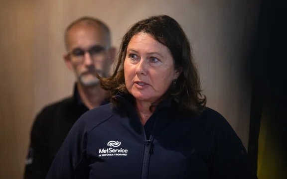
MetService meteorologist Georgina Griffiths earlier told the Herald this El Niño - which could prove among the most intense in decades - was coming with the most westerly forecast summer pattern she could remember.

MetService meteorologist Georgina Griffiths. Photo: RNZ / Cole Eastham-Farrelly
Those in the South Island's West Coast could expect more rain bands and fronts, while, in regions like Hawke's Bay, Gisborne, Canterbury and eastern Marlborough, those winds would instead arrive warm and stripped of moisture.
For Kiwis in centres like Wellington, who enjoyed relatively pleasant summers over the last few years of La Niña, the contrast would be especially stark.
"The big headline is that this summer looks to be absolutely different from what we experienced last year, which was a bummer summer in the north, and a great summer in the south," she said.
"The reverse is true for what we've got coming."
Today's cyclone season outlook comes after NIWA scientists recently reported how future tropical cyclones could grow even more destructive, thanks to a warming climate.
By the last two decades of this century, their modelling suggested that the storms' damage potential could worsen by about 10 percent in a middle-of-the-road emissions scenario - or by as much as 26 percent in a worst-case, though highly unlikely, scenario.
There was also uncertainty about their future frequency.
Rather than an increase, some scientists have suggested a slight drop, due to changes in the atmosphere resulting in fewer storms being needed to maintain the flow of heat from the tropics to the poles.
At the same time, however, there was some tentative evidence from projections that worst-case warming scenarios could bring a small increase.
This story was originally published by the New Zealand Herald.


