Wetlands and attenuation pond to be constructed on Penlink route

Lara Fagan
11 May 2023, 6:45 PM
 Penlink.
The Penlink project team are constructing three wetlands and an attenuation pond, to lessen the increased runoff generated by the new highway.
An attenuation pond controls stormwater runoff by holding and slowly releasing excess water, while the wetlands will also provide water treatments.
Whangaparāoa Road currently experiences overtopping during extreme weather events, which means the water rises over the top of the road and creates significant traffic disruptions and safety hazards.
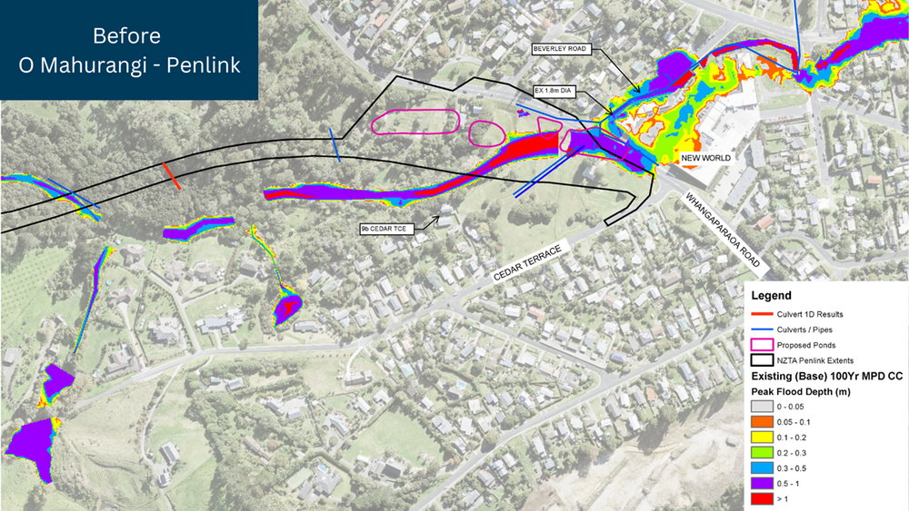
The map shows the 100-year event flood depth before Penlink is built.
Downstream flows are also very high, reaching 26 cubic metres per second (cumec).
At 26 cumec, it would take about one minute and 36 seconds to fill an Olympic-sized swimming pool (2,500 cubic metres).
Safety comes first for the Penlink team, so they decided to construct the three wetlands and an attenuation pond, to lessen the runoff stormwater.
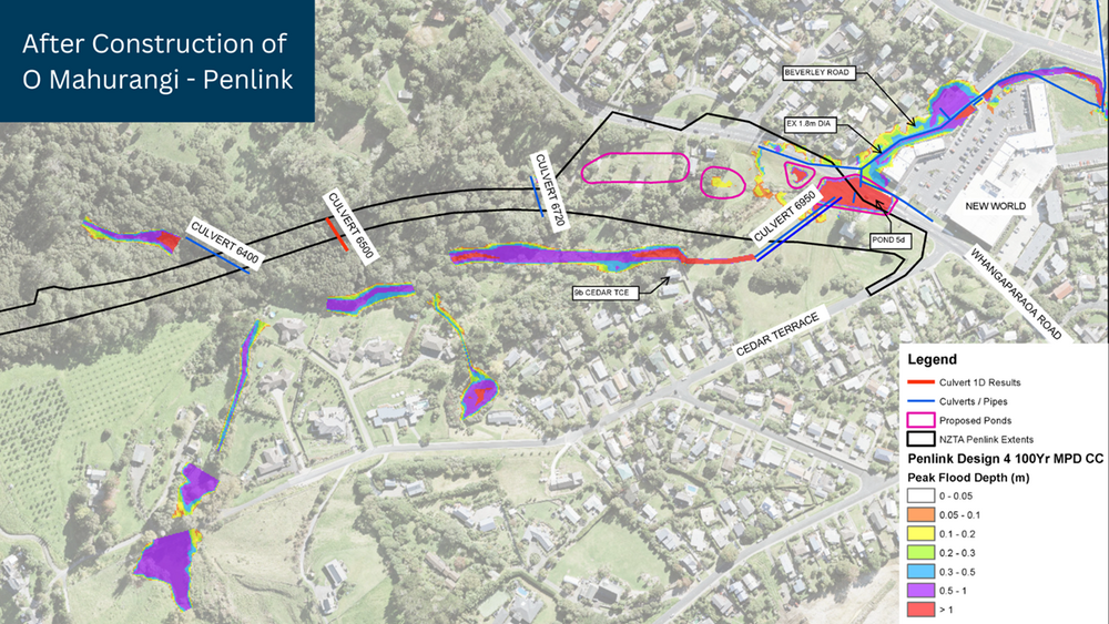
The map shows the 100-year event flood depth after Penlink is built.
Once completed, the new highway will not overtop (as in the ‘after’ image), and there will be a reduction in downstream flows, from 26 to 22 cumec.
At a 22 cumec flow rate, it would take about two minutes and 16 seconds to fill an Olympic-sized swimming pool.
The final designs must still get the council’s approval, but the proposed solution provides resilience and ongoing connectivity for the local area.